Friday, May 17, 2019

Down! In Capetown

I forgot to mention the weekend we were in Saint Louie, before Thom and Robin headed out, there was an International Jazz Festival with a few major headliners like Herbie Hancock.  People from Europe flew in for the concerts and the arts community.  Many restaurants and bars had performances to accompany dining.  So my previous descriptions didn’t capture the pockets of the music and art scene buried in the dust, grime, and crime.

In addition to attending a couple of performances, I bought a 4’ x 4’ painting by Zeus!  Hope Holt likes it.

Jazz singer in Saint Louie

Zeus and his art
Robin Holt arrived in Capetown on the morning of April 29 after 18 hours from Vienna to Capetown via a layover in London.  Thom, Robin Johnson (hereafter called Johnson to differentiate from Robin Holt) and I arrived that evening after 12 hours from Dakar through Jo’burg.  I started feeling kind of punky and went to bed after skipping dinner with the group.

On the 30th I was down and out: high fever, chills, body aches, and a nagging dry cough.  I couldn’t get out of bed in the morning so Thom, Johnson and Robin went out to walk around the ‘hood. By the afternoon I agreed to see a Dr because the clinic was just a block from the hotel.  After being interviewed I confessed I didn’t take the malaria meds for Senegal (neither did Thom or Johnson). The Dr admonished me, but also agreed the incubation period seemed way to short to be that.  Never the less I had to get a blood test for malaria (but you can’t prove a negative on the test).  I also had spots on my throat that seemed the likely cause.  The best I could conclude is that three days before, at the Jamm hotel in Saint Louie, I didn’t see bottled water in the room and drank from the tap.  When I asked Yves the next day he said the water wasn’t good, and there was bottled water in a cabinet I didn’t see.  The Dr said I should take the Azithromyacin antibiotics I carried with me.  I powered through dinner with the group that night, but quickly crashed again.  Totally without energy. 

The next morning I had arranged a driver and car to take the four of us south along the Cape Peninsula to Cape of Good Hope and Cape Point, neither of which is the Southern most point of the continent nor the dividing line between the Atlantic and Indian Oceans. But Cape of Good Hope has the geographic reputation because it is the SW most point of the continent and it was the most difficult transit rounding the tip of Africa.  Sailors called it Cape of Storms. It was clear for us, but even then, the crashing waves were impressive.  I was still feeling stormy inside.

Cape of Good Hope 


When we started our trip around the peninsula the Cape fog was in.  Our hotel room had a great view of Lions Head, but we couldn’t see it, and Table Mountain was totally covered in clouds.  We wondered if we’d even see Table mountain, let alone hike or ride the tram to the summit.  But as we passed Camp Bay about a half hour outside of Capetown we broke into the clear. 
Fog over the Atlantic  
On the way we stopped at the Boulders to see one of the few places outside of Antarctica that has penguins; the others are Chile, Argentina, and in the Galapagos, Ecuador.  Oddly, these penguins didn’t migrate from the closest land in Antarctica, but from South America across the Atlantic. 
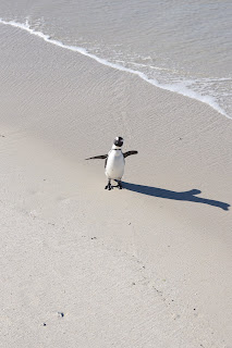
The African Penguin 

It is truly a spectacular setting with the city nestled in The Bowl surrounded by the mountains.  The tram to the summit closed at 5:00 pm and the last tram down was at 6:00 pm.  It was 4:45 and we asked our driver to drop us off at the ticket office.  Without a line we got one of the last trams up.  It is a stunning and iconic view.  
View of the Cape Peninsula from Table Mountain 

Sunset on Table Mountain 

Cape Town from Table Mountain 
Cape Town in the Bowl. 
Still feeling punky, the next day we explored Capetown and Robbin Island. 

Wednesday, May 15, 2019

Two Islands

Gosh, here we are in Timbavati Private Reserve next to Kruger N.P., South Africa, and I’m still writing about three weeks ago.  I need to pick up the pace, so less interpretation, and more travelogue, until I catch up.

For our last night in Dakar, we packed up and took a 20 minute ferry to the Isle of Goree.  This island is a UNESCO site and the first to recognize the slave trade from Africa.  Just south of here in The Gambia is the other major slave trade island that used to be called James Island.  It is now called Kinta island, after Alex Haley’s famous ancestor that supposedly was sold from there.

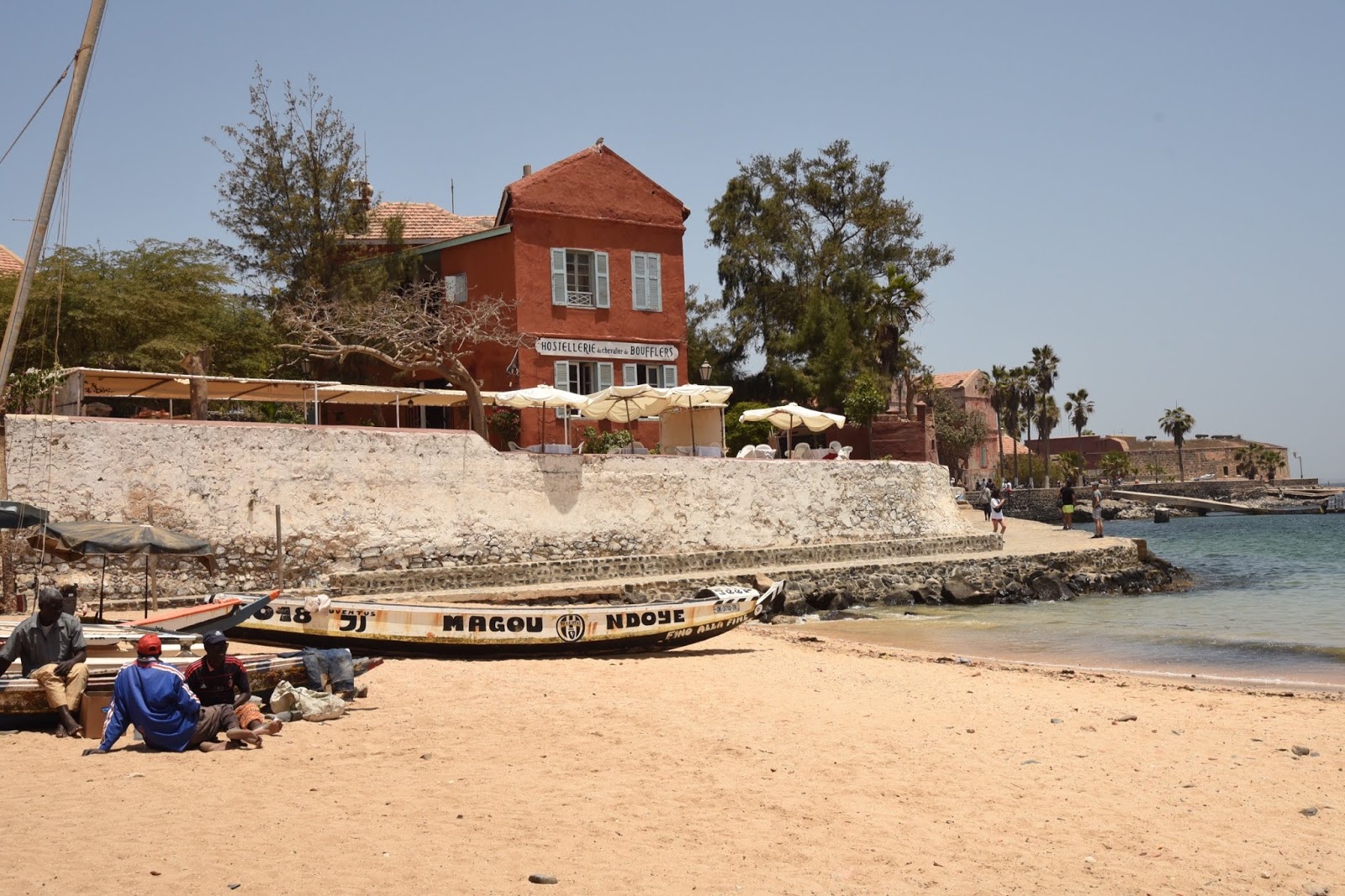
Isle de Goree
During the day Goree is filled with day trippers: school kids on field trips and the first white people we’ve seen in Senegal.  There is a thriving African arts community now on the island to cater to the day trippers.  We stayed overnight to experience the quiet and solitude after the visitors leave.  We stayed in a lovely compound that was managed by Miriam, a very competent and sweet single 28 year old.  After the last ferry, all the restaurants along the beach closed down, so we ate at a hotel restaurant overlooking the beach and ferry dock.
Day Trippers
Our Villa on Goree

Slave Trade Building, Goree
Freed Slave comes home to wife.
The next day after we ferried back to the mainland, a driver picked us up to for a three hour drive north to Isle Saint Louie, the former capital of French West Africa.  Enroute, we were pulled over several times by Gendarmes. Baksheesh? I asked the driver, and he confirmed he had to pay a bribe.  We eventually concluded that the police saw three white people in a car hire and figured they could get a little extra.  But our driver said it was common practice so that might have only been an additional excuse.  
Genedarmes shaking down our driver 
In Saint Louie the three of us stay at Hotel Fil de Fluer. Mary, the owner, was born in Normandy but is of Senegalese heritage.  She now spends six months in Saint Louie and six months back in France.  She was interviewed by Anthony Bourdain in his Parts Unknown episode on Senegal as a keeper of the countries culture on Saint Louie.  Because our hotel was booked after my first night I transferred to Jamm hotel about a quarter mile away in the center of the small island.  The owner of Jamm is Yves who is French and married to a Senegalese woman.  Together Mary and Yves negotiated the creation of a Guesthouse category for transient stay on the island as small guesthouses didn’t fit into any “rule” the government had for hotels.  They both champion the hospitality of Senegal.
Hotel Owner Mary 
After two nights on the island, Thom and Robin transferred back south to a beach resort area near the Dakar airport for a little R and R from the intensity of traveling Senegal.  I stayed an extra day up north and got a driver to go to Richard Toll, a small town at the boarder with Mauritania and on the fringe of the Sahara Desert.  This was a classic third world border crossing:  drifters, trucks, bribes, shops and hawkers.  Thinking I wanted to cross the river illegally on a pirogue in order to set my foot there, I watched my driver bribing a both a customs official and boat owner.  When I finally understood what was happening I said, “No, no no”.  While intrigued, I didn’t want to get across without a visa and not be let back in.  The next day I transferred down to Popeguine and met up with Thom and Robin for an afternoon on the beach.  
Border Crossing to Mauritania 
Border Crossing 
My visual impression of Senegal after a  week driving south to north and south again; from the major city of Dakar, to the tourist towns of Goree and Saint Louie, to the hustle bustle of a backwater boarder crossing is:  trash, walking, and colorful women.  The highways, side roads, and fields are covered with trash.  Plastic bags are blown around and caught into the barren branches of shrubs and trees.  And no one seems to notice or care.  As Mary said, most people are uneducated and have no aesthetic understanding, so most just don’t see it.  Those that do, it’s low on their priority.  To get from one place to another they walk.  They have Sept Place, dilapidated station wagons that can hold up to seven people (Sept) that shuttle people around, but most everyone just walks.  Kids going to and returning from school in their uniforms seem to be walking miles each way.  Men going to and from their labors walk. Women doing their laundry or buying necessities or selling product carry loads on their heads and walk the empty desert fields littered with trash.  Finally, in all this walking through all the trash, the women are beautifully and colorfully dressed in clean lovely flowing outfits balancing their goods on their heads.  They are in stark contrast to the sandy roads littered with plastic.  

Trash

Walking
Colorful Woman
After Popenguine we head to Cape Town and Rendezvous with my Robin who’s had her own adventures in Eastern Europe with Susan.  
Beach at Popenguine 
Final Dinner Popenguine 


Tuesday, May 14, 2019

Dakar

Thom and Robin arrived at Hotel Fleur de Lys the next morning.  We commiserated about my phone theft, but Robin related:  “Thom and I agreed, if there’s anyone to not have it ruin the trip, it’s you”.  Yes, bummed, but I still have my iPad to communicate, my DSLR for photos, and insurance.  That said, I was cautious this next day and decided to rely on my friends for photos, rather than take an expensive camera onto the streets until I got a better feel for risk.

Our first day together we walked to the plaza where I met Baboo.  As we crossed the plaza I again heard greetings called out but this time we ignored them. Then I heard “Mr. Bill”.  I turned and there was Baboo approaching me like a long lost brother.  We hugged and I introduced them to my friends who looked in wonder that I already knew a local.  I laughed with Baboo that he could not take them to the factory because we were busy today, and we headed to the Museum of African History.  
The Museum is in a new building with an excellent display on the origins of early hominids.  I was very moved looking at their rock art, human skeleton models, and thinking about our common early ancestors on the plains of Africa.  I’ll discuss this more at the Cradle of Humankind outside Pretoria. 

In the evening we walked to a restaurant not far from our hotel in Plateau.  Being in a group of three we generally felt safe walking the unlit streets at night (kind of like hiking in Grizzly country).  So far in two days I hadn’t seen a single white person and the restaurant was no exception.  It was a nice French bistro with a good cocktail bar.  A group of musicians were playing a rhythmic african beat and encouraged the local ladies to get up and dance, which several did. Culturally, an attractive Senegalese woman has a large bottom and is equally proportioned above.  They do serious booty dancing.  They can move parts of their bottom like Hawaiians - separately, together, in opposition.  These very large woman are incredibly sexy in their movements.  “It’s all about the base, the base, the base”.  But they are not doing it for tourists.  After the dancing, one woman politely came by and asked us not to take any more video.  We felt very fortunate to participate with them in their local culture and happily obliged.  

Our second day together we hired a driver to take us to the north end of the City - Almadies.  We drove by a main attraction of the city the African Renaissance  Monument. This heroic statue is in celebration of the freedom of the African from the bondage of slavery.  

We continued northwest until we reached Point des Almadies, the furthest West Point of the African Continent!  While some see no value in going to the furtherest (name your compass point) of a continent, I always find it humbling - whether at Terra del Fuego in South America, Antarctica, Cape Flattery on WA Coast, or Cabo de Roca in Portugal; I always stare across the expanse of sea and visualize human’s smallness in the vastness of the world.


After our lunch, we asked our driver to take us to Yoff, a traditional fishing village not far from the point.  The sea was rough that day and most of the fishing boats, pirogues, were on shore.  Hundreds if not thousands of them lined gunnel to gunnel, stern to bow, for over a mile.  Some still ventured out because it was their only livelihood.  The crew would roll their boats from above high water on logs or inflated drums into the crashing waves, then gun the engine to break over the surf before the next wave swamped them.
This stretch of beach was absolute squalor.  I’ve not seen anything like it except maybe in India.  Piles of rubbish, plastic and fish remains.  Woman in their colorful outfits, worked behind the row of boats gutting and cleaning the fish the men brought back.  They’d drop the heads and offal into plastic tubs, then carry the full stinking tubs on their heads to the water line and dump the contents onto the beach.  Crows, goats, and cats would scavenge the filth to find morsels to devour.  Weaving between the slop, women and men pushing pirogues out to sea were donkey driven carts on large rubber tires hauling supplies back and forth.  

Our dinner that night was in a traditional Senegalese restaurant and we all had Yassa, a spicy dish of onions, chicken and rice.  After two days (three for me) in Dakar we planned several nights on two islands, one off the coast of Dakar called Goree, a slave trading port of the sixteenth through nineteenth centuries,  and the other the former capital of French West Africa, before break up into multiple independent states in the 1960s.  

Saturday, May 11, 2019

The First Six Hours

Yellow fever is endemic through tropical Sub Saharan countries from Senegal to Ethiopia.  You are required to show your WHO Yellow Immunization card confirming your vaccination if you visit any of these countries prior to departing for South Africa.  Robin, couldn’t take the vaccine so she departed NYC for Budapest, Bratislava and Vienna with her girlfriend Susan, while I went to Senegal.

After a seven hour flight, I arrived in Dakar in the early morning, a day before Thom and his wife.  We elected to stay in the Plateau district, which is the oldest section of the city.  The embassies and “financial” center of Dakar is in the newer section, Almadies north of Plateau, but we didn’t want to stay with the Europeans - we wanted Africa!

I was picked up by Hotel Fleur de Lys for the half hour drive into town, and checked in.  My first impression looking out the hotel window was of Amman Jordan.  Low rise dun colored buildings, cracked stucco flaking off the mud or concrete block walls, dusty unpaved streets, filthy windows, and in the distance the minarets and the soothing call to prayer of the muezzin echoing through the city. Ahh, love it.  
After a shower and a brief nap, I ventured into the labyrinthine.  The people are black, I don’t mean chocolate or dark brown, but almost a steel blue-black.  And they are a handsome people.  The men wear the tradition booboos, a long pull-over robe the length between their knees and their ankles, worn over billowy pants of the same colorful fabric.  On the street corner, a barber shaves their heads over which they wear the knitted Muslim cap.  The woman are colorfully dressed with a turban or just a pile of matching cloth on their head to block the sun. Frequently they are transporting a tray or basket of goods on top of that.
I venture through the streets toward a plaza.  There are no whites around.  I am often approached very friendly, sometimes hawking without pressure, sometimes just a greeting to an obvious foreigner.  In the plaza a tall, 6’4” middle aged man in a yellow pollen colored booboos strikes up a conversation.  His name is Baboo.  As we walk Baboo tells me his story - four wives, one is no good, works as a guide in a hotel, etc. Eventually, he wants me to see his “factory” where they make and sell african garments.  I know the routine.  He doesn’t own any factory, but gets a commission for brining someone. But I like him so I agree.  At the factory, a dark, low ceiling windowless warren of cloth and sewing machines, and stacks of beautiful colored african shirts, booboos, women’s outfits, etc..  The short, toothless hawker entreats me to buy something.  Like a middle eastern rug seller, he pulls out shirts, blouses, and bolts of fabric one after the other all “made by the boys, buy something to help the boys”.  But it’s the start of the trip and I’m not in the mood to buy, I just want to immerse myself.  I convince the hawker I’m not buying and we leave after painfully sad looks.  I tell Baboo, I just want to explore alone now, but he’s not done yet.  Failed at his commission, he now makes a personal plea.  He tell’s me he likes me etc and gives me a little African choker as a gift, “not for payment”.   Then he asks for some money to buy rice for his kids. I like him, and they are desperately poor here so I give him a 1000 CFA (about a dollar). And we part on acknowledging the goodness of each other.  We are now brothers.
I wander my way to the local market set up in a gravel lot.  Dozens of vans have transported people from far away villages to shop here. It’s fascinating, but slightly uncomfortable.  Hundreds of poor people barely getting by and going through their necessities, with a tall white guys wandering around them “for pleasure”.   There’s a section where vehicles are lined up for mechanics to repair, there’s the clothing section, household section, vegetable section, meat section, and even a “fast food” section, where women have set up make shift kitchens to cook rice and grille slices of freshly butcher meats, under a corrugated tin roof lit by candles.  It’s compelling visually, so I take my iPhone and photo the women behind the fires.  I forgot, Muslims don’t like their photos taken - images are idolatry - and I get yelled at.  I apologize and walk away, but as I do so I catch out of the corner of my eye a young teenager surreptitiously following me from a distance.  I stop, he stops.  I circle back, he circles back.  I wait at a cross walk, he waits. I glare at him, he looks the other way.  Hmm, I don’t think he’s up to any good.  He saw my iPhone, and they are pretty valuable here - several months wages even at a discounted price.  I walk to a main thoroughfare and hail a taxi for 1000 CFA and leave him behind.  

I get off some distance away and decide to walk toward a viewpoint.  I’m approached by a very engaging person, but there was something less genuine about his approach, and while friendly, I dismiss him.  But he keeps slightly ahead of me on my right, chatting, grinning, and complementing me on my pants.  Out of the corner of my eye I catch another person behind me on my left.  Suddenly, the man in front reaches down and tugs on the fabric of my left knee commenting how sturdy the fabric is, and I push him away.  He finally leaves.  When I reach the viewpoint I reach for my iPhone in my left pant pocket and it’s gone.  Instantly, I know what happened. Distracted by the tug on the pant by the guy in front, the guy behind, who I never really saw, slipped the phone out of my pocket.  Smooth as silk!  My first six hours in Senegal.  

Photos courtesy of Robin Johnson.  My photos were stolen.

Wednesday, May 8, 2019

Ideation, Planning, and Execution

Travel to Africa has been a desired travel destination for decades.  But how to decide where to go?  By profession or nature, I tend to see forests for trees.  My view of potential Africa destinations is the Maghreb along the north coast, West Africa, East Africa, Southern Africa, and Central Africa.  We’ve been to the Maghreb, Central Africa is in too much political turmoil and violence, I knew little about West Africa except that it’s not well known for its game reserves.  So that left the countries of East Africa and Southern Africa.  Yet for some reason the time or opportunity never seemed right to pull the trigger. 

In 2017, long time friend Thom canceled his plans for a trip to South Africa to attend our wedding in Italy. In 2018 he talked about rescheduling his trip for 2019.  That provided the opportunity we needed to make the commitment for a journey to the other side of the world.  

Thom and I traveled together to Antarctica in 2003 for our 50th birthdays, did our “post soviet” tour of Moscow, Ukraine, Slovakia, and Budapest in 2015, and in 2016 he and his wife (also named Robin) and we traveled to Colombia together for a portion of our extensive South America trip.  Since he’d already been to East Africa two decades prior, that focused us on Southern Africa. 

In August 2018 we moved beyond ideation to detailed planning and reservations.  We both love the research and planning aspect of travel almost as much as the experience.  However, we have different styles and priorities;  I tend to research history, geography, and culture; while Thom tends to research trends of contemporary society: restaurants, politics, hip or gentrifying neighborhoods, and economics.  Over the next eight months of planning and reservations, the two perspectives balanced our agenda.

After deciding South Africa and a safari on a reserve near Kruger will be the primary objective, Thom and we saw an episode of Parts Unknown where Anthony Bourdain visits Senegal in West Africa.  (We miss him). Senegal is the longest ruling democracy in Africa, it’s includes the western most point on the continent (a geography geek thing), it is a former French Colony (Thom speaks French) and they have excellent cuisine.  It also seemed more “African” than South Africa.  As we peeled the onion of opportunity I figured that a five hour flight to NYC to visit the girls and a week layover in Senegal would nicely break up the long flight across the Atlantic to the continent.  The final leg, all in Africa, from Senegal to Capetown via Johannesburg would be as long as the previous two flights combined - five hours, seven hours, and twelve hours.  It’s a BIG continent. 

Having established Senegal, Capetown, the wine country and the southern coast called the Garden Route, Robin and I decided we wanted to take a train from Capetown to Johannesburg, embarkation for our safari destination.  The start of the train ride  would be where Thom’s and our itineraries would part.  Since we were half way around the world and we’d be at the northern border of South Africa we thought we should visit the rest of the Southern African countries.  From the safari on a reserve outside Krueger, our travels continued a counter clock-wise loop through Victoria Falls in Zambia and Zimbabwe, water based safari in the Okavango delta of Botswana, and concludes with two locations in Namibia.  Details of all to follow as we experience them.

For our return to Seattle, Thom’s wife found a 12 hour non-stop flight from Johannesburg to Hong Kong, followed by another 12 hour non-stop flight from Hong Kong to the West Coast.  Although Johannesburg is not quite half way around the world, surprisingly the flight continuing east was cheaper and faster than returning through Europe or Senegal, and it gave us a two day break in a great city.  


During my professional life I’d flown around the world six times, but this was always in the Northern Hemisphere, and never along The Great Circle Route: the shortest distance between any two points on a sphere is along a plane that passes through the center of the earth.  The equator is the most obvious example. This is why when flying from the Seattle to a similar latitude in Europe, the flight path is typically over Canada, Greenland, and Iceland, not due east.

As I mentioned in my NYC blog, I am a geography and cartography geek.  This particularly routing appealed to my sense of completeness. Because the earth is 75% covered in oceans it’s difficult to find major city airports to circumnavigate the globe on the Great Circle Route.  Below is our routing. To make this a perfect Great Circle route we’d need to fly from San Francisco instead of Seattle to NYC, and to Sydney instead of Hong Kong from Johannesburg.  But we are pretty close. 


My next post “The first six hours” will be my arrival in Senegal and from then on it’ll be about the travels.  

Sunday, May 5, 2019

We’ve been fooled

When we think about Africa, when we think about it at all, we have a general impression of its size.  Maybe slightly larger than South America, occupying the same location in the eastern hemisphere as its cousin in the western; or some other comparison.  However, we’ve been fooled by how the earliest world maps distorted size and shape.

Some have claimed that world map projections prepared by the west represent inherent bias by making undeveloped countries look smaller than the developed countries.  However, this ignores the perspective and needs of earlier times.

As the age of Discovery and Exploration evolved, cartographers needed to find a way to project the surface area of  a sphere onto a flat, two-dimensional drawing.  And the need for that was not racist it was pragmatic to solve a problem:  navigate across vast oceans using primitive navigation tools: a compass, a sextant, and a watch.  

The needs of early ship pilots/navigators were for lines of constant bearing (rhumb lines) that are straight.  One of the earliest projections was the Mercator projection from 1569. This map was still in use when I went to school and where most of us were given our impression of the relative size of continents and countries.  This type of map is called a Cylindrical projection.   


Envision a piece of paper wrapped around the equator of a globe and all lines of Longitude, which run N and S from pole to pole, were projected from the center of the earth through the lines of Latitude onto that cylinder. What this does is stretch the land wider and taller as the projection moves from the equator toward the poles.  The land  areas and oceans at the “high latitudes” (toward the poles) are depicted larger than the land  areas at the equator.  Thus Africa, Central and South America, and India between the Tropic of Cancer and Capricorn (23 degrees N and S of the equator) look considerably smaller than they  actually are relative to the land at high latitudes. Alaska looks larger than half the US and Greenland looks larger then all South America.  


With our lack of knowledge of Africa, the continent looks slightly larger than the size of South America.  But that is deceiving.  All the area of the United States, China,  Western Europe, Eastern Europe, the UK, India and Japan all fit within the coastline of Africa! 

 Since the late 1500s cartographers and mathematicians have continued to develop many types of projections of the earth for various purposes: to show constant Great Circle Routes, Equal Areas, Equal Distances.  These projections, and multiple derivatives called pseudo - Cylindrical (or whatever the baseline was) gives us multiple ways to look at our planet’s surface.  And some eliminated perceived bias. 


One of my favorites is from the architect/mathematician Buckminster Fuller, the inventor/creator of the Geodesic Dome.  If you fold it along the joining lines you can create a “globe” like a Bucky Ball.

All this is to say Africa is Very Very Large.  How we began to develop a concept for travel to this continent, even in six weeks, then plan and execute it is the subject of my next post.